Click on images to download. Warning, images may be large files.
- Annotated map of Luton and surroundings showing Biscot Camp. Original held at BLARS ref: WW1/VA4/2/1

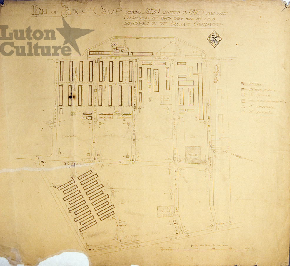
- Plan of Biscot Camp, showing the area alloted to units, specifically Headquarters, Battery on Duty, A, C and D Battery and 595 H.S. Employment Company; scale 64 feet: 1 inch. Original held at BLARS ref: WW1/VA4/2/2
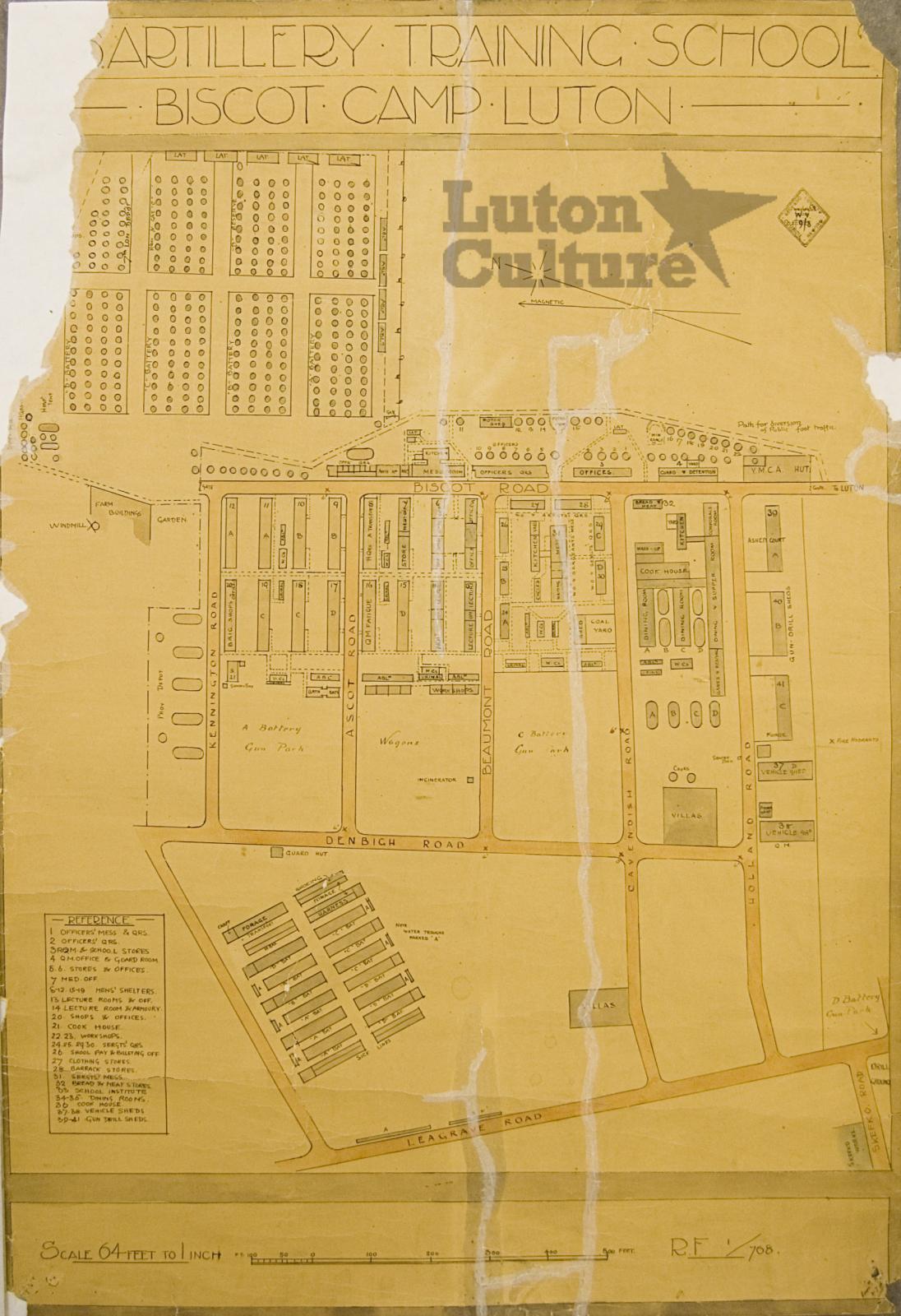
- Plan of Biscot Camp in greater detail than WW1/VA4/2/2 showing the position of and naming all individual buildings; scale 64 feet: 1 inch. Original held at BLARS ref: WW1/VA4/2/3
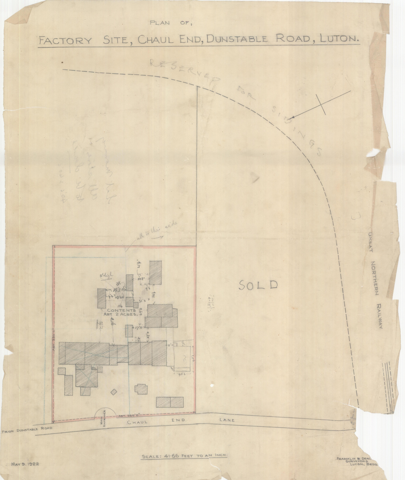
- Plans of George Kent's Works in WW1, showing various layouts of buildings at the once secret National Filling Factory at Chaul End. The factory occupied a 28 acre site between Dunstable Road, the railway line (now busway) and Chaul End Lane.